Geomatics
Advertisement
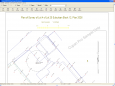
Copan for PocketPC v.1.0.7
Copan for Pocket PC is a very functional and easy-to-use geomatics engineering tool for computing and managing plane surveying and mapping coordinates. It does numerous coordinate geometry (COGO) calculations, processes and adjusts raw field survey
Advertisement
Copan for Windows v.10 9
Copan for Windows desktop/netbook is a very functional and easy-to-use geomatics engineering tool for computing and managing plane land surveying and mapping coordinates. It does numerous coordinate geometry (COGO) calculations, processes and
Copan for Mobile v.1.0.7
Copan for Mobile 6 is a very functional and easy-to-use geomatics engineering tool for computing and managing plane surveying and mapping coordinates. It does numerous coordinate geometry (COGO) calculations, processes and adjusts raw field survey
CopanMobile for PalmOS v.1.0.3
CopanMobile for Palm OS is a very functional and easy-to-use geomatics engineering tool for computing and managing plane surveying and mapping coordinates. It does numerous coordinate geometry (COGO) calculations,
CopanMobile for PocketPC v.1.0.2
CopanMobile for Pocket PC is a very functional and easy-to-use geomatics engineering tool for computing and managing plane surveying and mapping coordinates. It does numerous coordinate geometry (COGO) calculations,
FreeView v.10 3
Geomatica FreeView is a flexible data viewing tool supporting over 100 raster and vector formats for loading, viewing, selection, and enhancement. FreeView is useful for any geospatial data viewing application, and is freely distributable.
Developers' Tools v.1.0.0100
Developers' Tools® 4Xpert... It is an integrated application to AutoCAD®, which turns it to a powerful tool for the Surveyors, Engineers, and Architects.
Geomatica FreeView v.9. 1. 2005
Geomatica FreeView is a flexible data viewing tool supporting over 100 raster and vector formats for loading, viewing, selection, and enhancement. FreeView is useful for any geospatial data viewing application, and is freely distributable.
GeoclipSolo v.2.5.0.33
Géoclip Solo includes a building tool which is described above. It also includes a base map conversion tool (see picture opposite). The geographic layers which are assembled to build a géoclip are in the swf format.
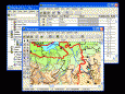
GIS ObjectLand v.2. 6. 2003
GIS ObjectLand is a universal Geographic Information System for Windows. Key features: - creation of vector-raster maps with arbitrary structure of layers and feature types; - creation of themes. Theme is a user presentation of a map; - control of
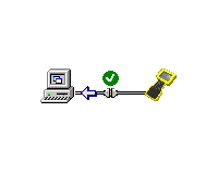
Trimble Data Transfer v.1.55.0.1
The Trimble Data Transfer software transfers data from a range of devices to your PC.